Tra Co Beach
With the extensive beach of smooth white sand and blue transparent water, Tra Co Beach is the border of a natural island which is created by the impact of waves and sea stream onto the shore.
Tra Co is located on the far northeast of the country, in Quang Ninh Province, bordering China, and is 9km away from Mong Cai Town. It is 206 kilometers from Hai Phong City to Mong Cai Town. However, some other prefer to depart from Hon Gai (Ha Long) for a shorter distance of 132 kilometers.
.jpg)
On the way to the beach, tourists may notice crowded villages living mostly on fishing activities on both sides of the way, a number of high sand dunes of 3-4 meters, stretching rows of casuarinaceae preventing sand storm for the local residents, and mangroves from a far.
Tra Co Beach stretches over 17 kilometers long from Got Tip in the North to Ngoc Tip in the South. Thanks to the huge size, the beach is capable of accommodating a large number of tourists at a time. Thanks to a far distance from the city and industrial zones, Tra Co atmosphere is cool and fresh that bears solitudes and primitive patterns. The year’s average temperature of Tra Co is 22.7 Degree Celsius. There are four months when it goes below 20 Celsius degree (December to March), and the .highest temperature recorded is 28 Celsius degree only in the summer.
Most tourists prefer Tra Co Beach because that there are very few shops, restaurants, and street vendors here. If tourists want some fresh seafood, they can find it easy and cost-saving from fishing boats anchoring on the shore at its freshest.
.jpg)
If tourists come to Tra Co at the end of lunar calendar May, they can take part in “Tra Co Festival”, which occurs from May 30 to June 6 of the year. During 6 days of the festival, all the quintessence of Tra Co is revealed to tourists.
See more
-
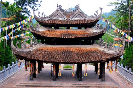
Emperor Jade Pagoda
Emperor Jade Pagoda, also known as Tortoise Pagoda, is one of the five most important shrines in Ho Chi Minh City. Built at the turn of the 20th Century by a community of...
-
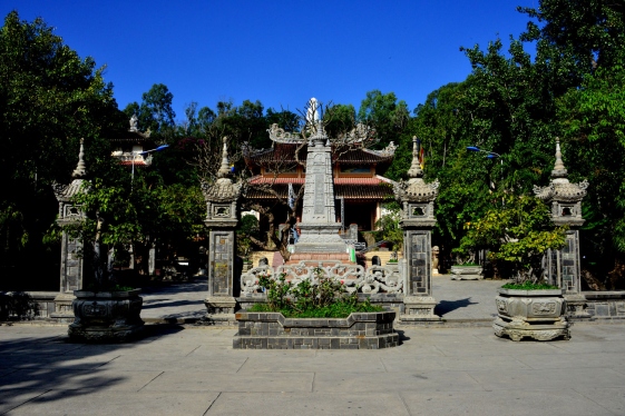
Long Son Pagoda
Long Son Pagoda, also well known as White Buddha Temple (Behind the pagoda is a huge white Buddha seated on a lotus blossom) is one of the most beautiful pagoda with an...
-
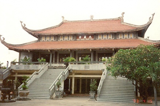
Giac Lam Pagoda
Giac Lam Pagoda, built in 1744, is the oldest Buddhist temple in Ho Chi Minh City and as such was listed as an important historical site by the Vietnamese Department of...
-
.jpg)
Long Bien Bridge
If Hoan Kiem Lake with special green water and the red bridge named The Huc is the symbol of an elegant and charming ancient city; Red river and Long Bien bridge may be seen...
-
.jpg)
Yen Tu Mountain
Yen Tu Mountain is one of the highest peaks in the Dong Trieu Mountains in the north-eastern area of Vietnam, located within the area of Uong Bi Town, Quang Ninh Province....
-

Imperial Citadel of Thang Long
The Imperial Citadel of Thang Long is an outstanding place of interest not only for the Hanoi but also for the country as a whole and was inscribed on the World Heritage List...
-
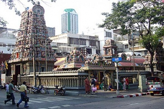
Mariamman Hindu Temple
Situated close to the Ben Thanh market, the Mariamman Hindu temple serves the small community of 100 or so Chinese and Vietnamese Tamil Hindus living in Ho Chi Minh City.
-
.jpg)
Hanoi Ancient House at 87 Ma May Street
Located within Hanoi Old Quarter, the ancient house at 87 Ma May street which was built at the late of the Twentieth century, is quite intact with typical architecture of...
-
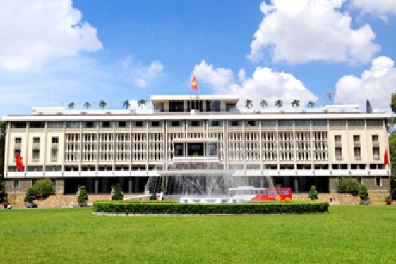
Reunification Palace
Reunification Palace is (known as Independence Palace) the famous historical witness which passed through the two fierce wars against the French and American...
-

Vietnam Museum of Revolution
If you are touring along Tran Quang Khai road or Tong Dan street, chances are that you will be stopped out of curiosity and admiration by the unique French style architecture...
Destinations
Most popular tours
-
Visit Tho Ha Traditional Village
Price from: 23 US$
-
Central Vietnam Gateway
Price from: Contact
-

Vietnam Highlight Tour
Price from: 500 US$
-

Northern Classic Tour
Price from: 310 US$
Business info
Vietnam Local Guide
- Address: 18th Floor, VTC Online Tower, 18 Tam Trinh Str.,Hai Ba Trung Dist., Hanoi, Vietnam
- Email: info@vietnamguider.com
- Phone: (+84) 0904989890
- Hotline: (+84) 0904989890